Planned burn in partnership protects key environmental, power assets
Issued: 2 Mar 2024
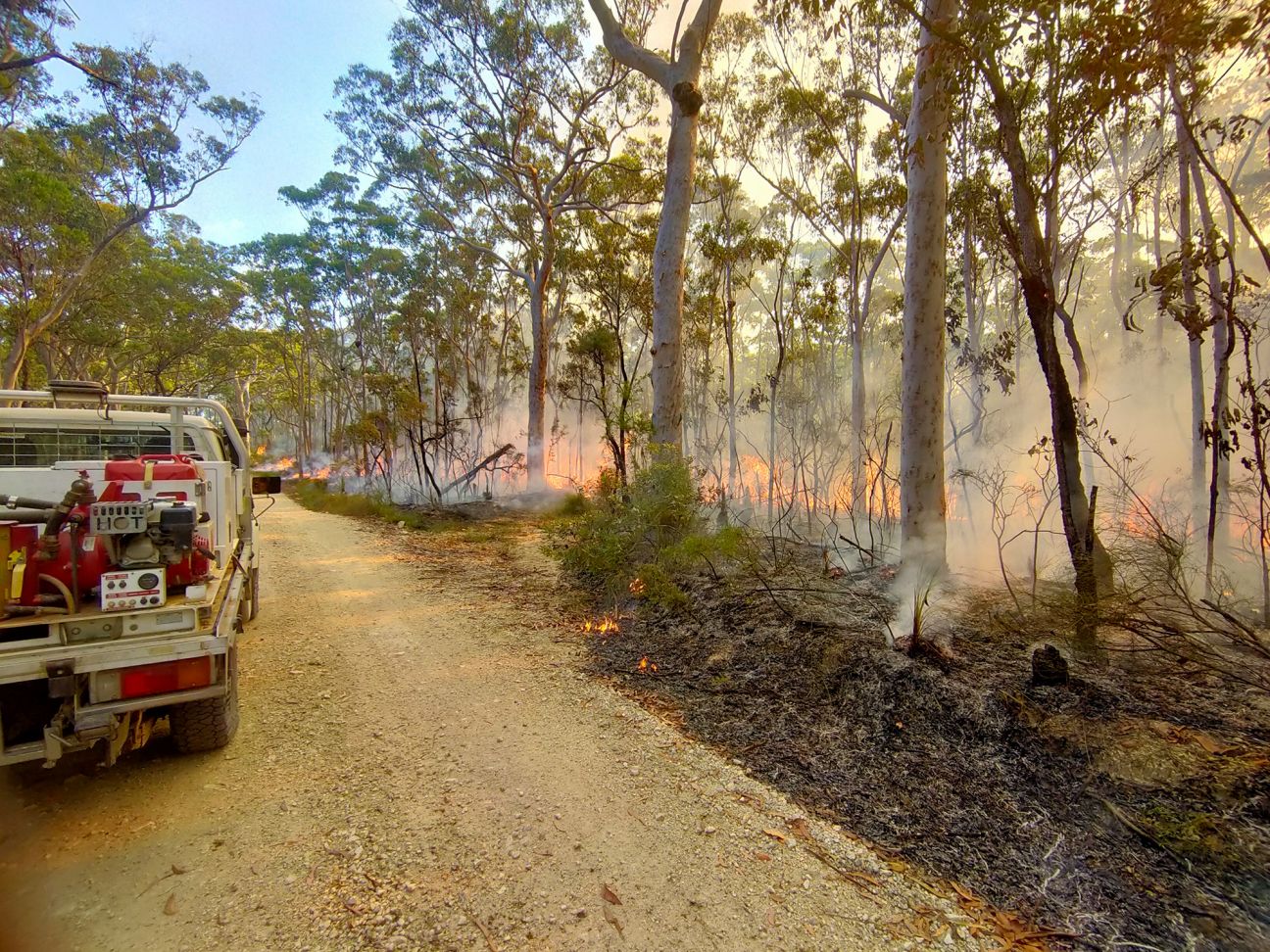 Open larger image
The aim of the burn is to reduce the impacts of bushfires on key environmental areas.
Queensland Parks and Wildlife Service (QPWS) has partnered with Powerlink, Queensland Fire and Emergency Services (QFES) and neighbouring landholders to protect crucial habitat in D’Aguilar National Park through a broad-scale planned burn operation.
Between now and Sunday, rangers and partners are carrying out strategic burning across 1,500 hectares in the Mount Mee section of the park.
Sections of the park will be closed over the weekend, including some four-wheel drive and walking tracks.
Multiple severe weather events and higher than anticipated rainfall across Queensland over summer have increased grass fuel loads in many protected areas.
Fortunately, the recent wet weather has also created favourable conditions to conduct planned burns earlier than usual.
This is the first time rangers in D’Aguilar National Park have partnered with Powerlink to undertake a strategic burn since 2010, which is aimed to reduce the impacts of bushfires on key environmental areas and assets such as hoop pine plantations and QPWS infrastructure.
North D’Aguilar Ranger in Charge Scott Bowden said the burn was part of a year-round mitigation strategy to protect the national park and surrounding areas from severe bushfires.
“We plan to deliver a mosaic pattern of burnt areas to reduce the volume of forest fuels and reduce the potential spread of bushfires near Mount Mee,” Ranger Bowden said.
“The planned burn aims to reduce the intensity of any subsequent bushfires and provide favourable conditions for maintaining forest health.
“It’s great to get the opportunity to work with Powerlink and QFES on this burn to protect environmental values and community assets and reduce the potential for negative impacts from bushfires when they occur.”
As a result of the burn, smoke may be seen in the Mt Mee, Ocean View, Mount Pleasant, Lacey’s Creek, Dayboro, Somerset, Neurum and Woodford areas.
If smoke affects you:
- avoid driving through smoke where possible, and be aware of firefighters working in the area
- stay indoors and close windows and doors
- keep respiratory medication close by.
Information on smoke and dust health action levels and live air quality data can be found on the Queensland Government website.
You can stay updated with QPWS fire activities occurring locally by visiting Park alerts and by following Qld park alerts on Twitter and the Queensland Fire and Emergency Services Current bushfires and warnings web page.
Further information on the importance planned burns and QPWS fire management activities play in protecting communities and supporting the natural environment is available on the Department of Environment, Science and Innovation Fire management web page.